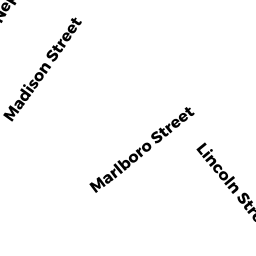
10 LINCOLN ST
Owner Information
REGAN MICHAEL W & DIANE T TRS
10 LINCOLN ST
NEWBURYPORT, MA 01950


Property Details
10 LINCOLN ST is classified as a Single Family Residential (Conventional).
The primary structure on this property was built in 1910. There are 2,404ft2 of built area within this property. There is 1,164ft2 of residential/living space within this property. This property is listed as having 60 rooms.
10 LINCOLN ST is valued at $442,100. The land is valued at $262,800 and the structures are valued at $177,900. There is an additional valuation of $1,400 on this property.
This property is in Zone R2. Confirm with local Zoning Board authorities to ensure there are no overlays or other easements on this property.
The most recent deed for 10 LINCOLN ST is recorded at the local registrar in Book 30576, Page 31. 10 LINCOLN ST was last sold on Monday, August 8, 2011 for $1.
Assessment data from fiscal year 2021.
Flood Data
According to the FEMA National Flood Hazard Layer, this property does not appear to be in a flood zone. It may also be in an area not yet reviewed. Nonetheless, confirm this information prior to taking any action.
To view the flood hazards around this property, create a FEMA "Firmette" Map of the area around 10 LINCOLN ST.
Broadband Internet Providers
| Provider | Type | Bandwidth (mbps) | |
|---|---|---|---|
| Comcast | Cable | 1000 | 35 |
| Verizon New England Inc. | DSL | 10 | 1 |
| VSAT Systems, LLC. | Satellite | 2 | 1 |
| HughesNet | Satellite | 25 | 3 |
| Viasat Inc | Satellite | 100 | 3 |
| GCI Communication Corp. | Satellite | 0 | 0 |
Broadband service provider data from December 2020.
Adjacent Properties
- 12 LINCOLN ST
Single Family Residential owned by VANAMBURGH MARGARET A - 8 LINCOLN ST
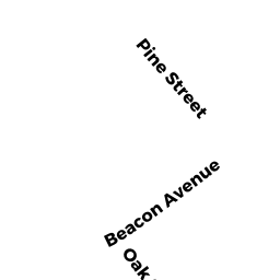
Single Family Residential owned by SHEPARD MICHAEL T - 20-22 BEACON & 11 PINE ST
Other, Open Space owned by CONDO MAIN - 20 BEACON AVE UNIT 1
CONDO MDL-05 owned by HARRINGTON DONNA M - 20 BEACON AVE UNIT 2
CONDO MDL-05 owned by BALKIND RICHARD - 20 BEACON AVE UNIT 3
CONDO MDL-05 owned by MACBURNIE BARBARA - 20 BEACON AVE UNIT 4
CONDO MDL-05 owned by CORMIER LEA - 20 BEACON AVE UNIT 5
CONDO MDL-05 owned by KRES LAUREN - 20 BEACON AVE UNIT 6
CONDO MDL-05 owned by JOPPA HOMES LLC - 22 BEACON AVE UNIT 2
CONDO MDL-05 owned by KIMBALL PETER S - 22 BEACON AVE UNIT 3
CONDO MDL-05 owned by CROWLEY WESLEY E - 22 BEACON AVE UNIT 4
CONDO MDL-05 owned by DULAC ELIZABETH - 22 BEACON AVE UNIT 5
CONDO MDL-05 owned by RHEMREV LEOPOLD A - 22 BEACON AVE UNIT 6
CONDO MDL-05 owned by EVANGELISTA PATRICIA A - 11 PINE ST UNIT 1
CONDO MDL-05 owned by VIGNEAULT ADAM R - 11 PINE ST UNIT 2
CONDO MDL-05 owned by RILEY GALE M - 11 PINE ST UNIT 3
CONDO MDL-05 owned by MARTEL PAUL - 11 PINE ST UNIT 4
CONDO MDL-05 owned by VANFOSSEN-BALKUS SHARON K TRS - 11 PINE ST UNIT 5
CONDO MDL-05 owned by HOEHN DEBORAH A TRS - 11 PINE ST UNIT 6
CONDO MDL-05 owned by SPELLMAN FRANCIS J - 22 BEACON AVE UNIT 1
CONDO MDL-05 owned by RUTTERS BROOK LLC